7 PINE POINT RD
Owner Information
DEEHAN ANTHONY F
60 BUCKMASTER DR
CONCORD, MA 01742


Property Details
7 PINE POINT RD is classified as a Single Family Residential (Colonial).
The primary structure on this property was built in 2010. There are 2,068ft2 of built area within this property. There is 1,912ft2 of residential/living space within this property. This property is listed as having 7 rooms.
7 PINE POINT RD is valued at $677,100. The land is valued at $428,000 and the structures are valued at $248,500. There is an additional valuation of $600 on this property.
This property is in Zone RC. Confirm with local Zoning Board authorities to ensure there are no overlays or other easements on this property.
The most recent deed for 7 PINE POINT RD is recorded at the local registrar in Book 36103, Page 0332. 7 PINE POINT RD was last sold on Monday, June 23, 2008 for $415,000.
Assessment data from fiscal year 2021.
Flood Data
This property is partially within the AE Zone (within floodplain). Approximately 0.35 acres (99.99%) of the property is within this zone.
The base flood elevation for this flood zone is 11 feet.
This information is sourced from the FEMA National Flood Hazard Layer. See our full disclamer.
Broadband Internet Providers
| Provider | Type | Bandwidth (mbps) | |
|---|---|---|---|
| VSAT Systems, LLC. | Satellite | 2 | 1 |
| Verizon New England Inc. | DSL | 5 | 0 |
| Viasat Inc | Satellite | 100 | 3 |
| Comcast | Cable | 1000 | 35 |
| Verizon New England Inc. | Fiber | 940 | 880 |
| GCI Communication Corp. | Satellite | 0 | 0 |
| HughesNet | Satellite | 25 | 3 |
Broadband service provider data from December 2020.
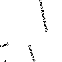
Adjacent Properties
- 11 PINE POINT RD
Single Family Residential owned by SCOTT FLORA A - 262 GURNET RD
Single Family Residential owned by MACFARLAND RUTH R - 435 GURNET RD
Recreation, Active Use (Charitable Org.) owned by DUXBURY BEACH RESERVATION INC - 260 GURNET RD
Single Family Residential owned by TRAINOR EILEEN (L/E) - 258 GURNET RD
Single Family Residential owned by DEEHAN VALORIE - 254 GURNET RD
Single Family Residential owned by KEITH EDWARD & MICHAEL D - 250 GURNET RD
Single Family Residential owned by DOLBIER TRACEY L - 8 PINE POINT RD
Single Family Residential owned by CARLIN ROBIN A TT